places Categories: Attractions and Mountains
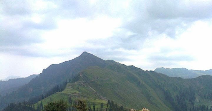
No Records Found
Sorry, no records were found. Please adjust your search criteria and try again.
Google Map Not Loaded
Sorry, unable to load Google Maps API.
-
- Pir Panjal,Bagh,Pakistan
Pir Panjal
Bagh
Pakistan -
Ganga Choti is a peak near the towns of Sudhan Gali and Bani Minhasan located in Bagh District, Azad Kashmir, Pakistan. Read more...
-
Kundas Forest (Kundās Forest) is a forest(s) (class V – Vegetation) in Azad Kashmir, Pakistan (Asia) with the region font code of Asia/Pacific. It is located at an elevation of 2,464 meters above sea level. Its coordinates are 33°52’40” N and 74°10’30” E in DMS (Degrees Minutes Seconds) or 33.8778 and 74.175 (in decimal degrees). Its UTM position is DT24 Read more...
-
Current time in Lunda is now 02:58 PM (Friday). The local timezone is named Asia / Karachi with an UTC offset of 5 hours. We know of 10 airports close to Lunda, of which two are larger airports. The closest airport in Pakistan is Rawalakot Airport in a distance of 26 mi (or 42 km), South-West. Besides the airports, there Read more...
-
Noori Chamb Waterfall in great numbers to beat the sweltering heat in plains. It is situated in just the midst of Behramgala & Chandimarh on Mughal Road, around 45 kilometers from Poonch District and has an elevation of 3480 meters. It is said that Mughal Emperor Jehangir admired the beauty so much that he named it as Noori Aabshar after Read more...
-
Keran is a village and tourist resort in Neelam Valley, Azad Kashmir, Pakistan. It is located 95 kilometers (59 mi) from Muzaffarabad on the bank of Neelam River at the altitude of 1,524 meters (5,000 ft). Neelam village is 2.5 kilometers (1.6 mi) away from here, The adjacent village on the other side of the Neelum river in Indian Kashmir is also known Read more...
-