places Category: Mountainsplaces Tags: Mountain peaks in Pakistan and Mountains in Gilgit Baltistan
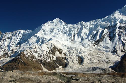
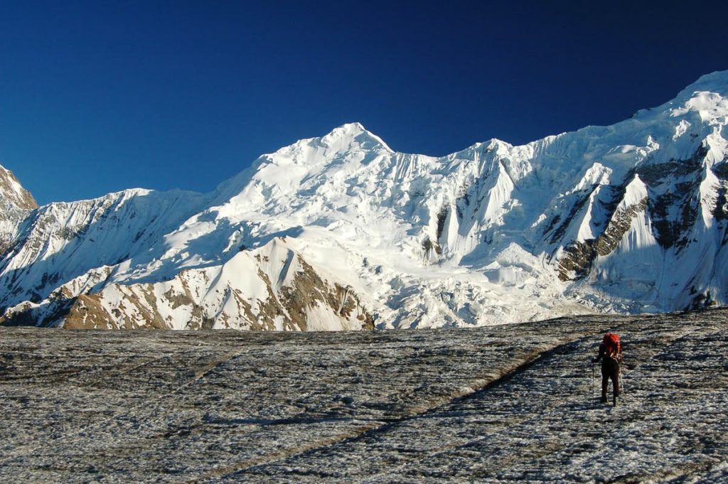
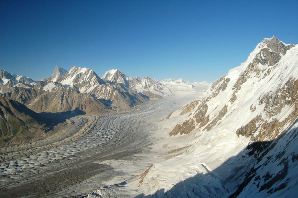
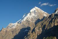
Haigutum East is a minor snow peak on the south side of the Hispar Glacier, the fifth largest glacier in Pakistan. The peak forms part of the beautiful Bal Chhish range which is a dividing marker between the counties of Nagar and Baltistan. ‘Haigutum’ refers to the grazing area further east and is the last pasture on the southern side of Hispar. Despite Haigutum East’s modest height it is an interesting, challenging peak to climb in a stunning part of Pakistan’s Karakoram. The peak would make a great introduction to the mountains of Pakistan for those with suitable climbing experience looking for a mid-grade route. It may however be problematic for inexperienced climbers due to route finding difficulties through numerous seracs and crevasses. It would also be a good choice for acclimatisation for for higher peaks.
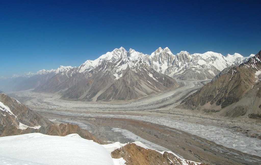
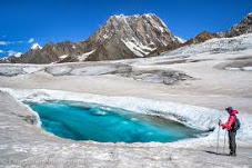
Haigutum East is a short trek from Snow Lake, one of the most uniquely beautiful spots in Northern Pakistan. The trek to base camp is also a memorable one skirting the southern faces of the Hispar Muztagh which contains some of the most impressive peaks in the Northern Areas such as Kunyang Chhish, Trivor and Pumari Chhish. The Bal Chhish peaks along the southern side are also very dramatic. In my opinion the Hispar glacier is more inspiring than even the Baltoro glacier.
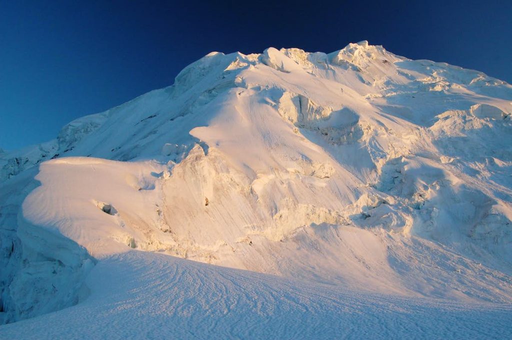
To the best of my knowledge the successful summit by me (Lee Harrison) and Peter Thompson was a first. We summited via a northern route from the Hispar Glacier in an Alpine style climb in two days making a high bivi at 5150m on route. The route is described here and the trip report is available here. No previous attempts have been made to the best of my knowledge and the south face remains unclimbed. This can be climbed from the Kero Lungma or Hucho Aichori valleys which extend north from where the Chogo Lungma glacier commences.
Climbing Conditions
The main challenge of climbing Haigutum East is finding a safe route through the maze of crevasses and seracs that litter the mountain. Many peaks in this area create the same objective dangers. Navigating seracs in the Karakoram is a dangerous affair compared to the Alps as avalanches are also numerous as seracs collapse in the summer heat. The rib that we climbed to the summit of Haigutum East via was evidently the only safe route on the north face. We first saw a photo of the Bal Chhish peaks in the book “Karakoram” by Shiro Shirahata published in 1991. Compared to his photo, in 2006 there were considerable more seracs highlighting the effects of rising global temperatures. P 6031 immediately west of Haigutum East has an even greater problem with seracs.
For many people visiting Pakistan’s Northern Areas for the first time the warm summer’s take time to adjust to. In Gilgit time temperatures regularly stay in their 30s during the summer and whilst it is cooler in the mountains it can still be uncomfortable at times. On days where there are no clouds a single layer will surfice and measures need to be taken to prevent sun burn. Weather can change quickly with fresh snow falling at any time in the year or heavy rains at lower altitudes. Come prepared for a range of climates. Nights are generally warmer during the climbing season compared to destinations such as the Pamir, Tien Shan or Napalese Himalaya and an early start when climbing is usually imperative to avoid soft snow in the afternoon. Often temperatures will not dip below zero at night time meaning snow conditions can be poor.
No Records Found
Sorry, no records were found. Please adjust your search criteria and try again.
Google Map Not Loaded
Sorry, unable to load Google Maps API.
-
- Haigutum Glacier
Gilgit Baltistan
Gilgit Baltistan
Pakistan -
FEATUREDFeaturedHispar Glacier (Urdu: ہسپر گلیشر) is a 49 km (30 mi) long glacier in the Karakoram Mountains of Gilgit–Baltistan, Pakistan which meets the 63 km (39 mi) long Biafo Glacier at the Hispar La (Pass) at an altitude of 5,128 m (16,824 ft) to create the world’s longest glacial system outside of the polar regions. Details This 100 km (62 mi) highway of ice connects two ancient mountain kingdoms, Nagar (immediately south of Hunza) in the west with Baltistan in the east. The extreme steepness of Read more...
-
FEATUREDFeaturedHussaini Glacier The Husseini Glacier is just on top of the Husseini village. The river flowing at the bottom of the picture just south of the village is the Hunza It is situated Nearby the most foamous Hussaini Hangging Bridge Known as the most dangrous Bridge in the world Hussaini Bridge is only one of the precarious rope Bridgees Read more...
-
FEATUREDFeaturedThe Makrong Chhish is and Barg in that Karakorum in that Pakistani Solar Territory Gilgit-Baltistan . The Makrong Chhish is with a height of 6608 m and of the highest bars of the Spantik-Sosbun Bar . He lies up on the south side of the Hisparglets . Up the overpass Siet, 15 km north-north-east, the Kunyang Chhish boasts a height of 7852 m in Hispar Muztagh . The Makrong Chhish is flanked in the East by the West by Read more...
-
FEATUREDFeaturedDisteghil Sar is the highest mountain in the Hispar Muztagh, a subrange of the Karakoram mountain range, in Gilgit-Baltistan, which is part of the Kashmir region that is disputed by India and Pakistan. It is the 19th highest mountain on earth and the 7th highest peak in Pakistan. Destghil sar is a Wakhi language word, that means “above the inner ranch.” The mountain has an about 3 km long top ridge above 7400m with three Read more...
-
Kanjut Sar or Kunjudh Sar as pronounced in “Wakhi” is a mountain located in the Hispar Muztagh, a subrange of the Karakoram mountain range. Kunjudh Sar in wakhi language mean that which overlooks Kunjudh, or above Kunjudh, while Khujudh is the wakhi name for Lower Hunza. It is the 26th highest mountain on Earth and the 11th highest in Pakistan. Read more...
-