places Categories: Attractions and Mountains
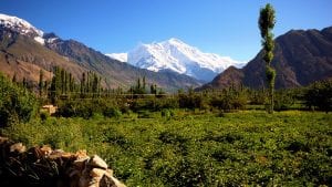
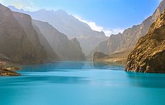
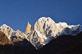
Rakaposhi (7788m) is one of the most beautiful peak and the world�s 29th highest mountain. It dominates the horizon and watches over the Karakoram Highway as you travel from Gilgit to Hunza. The peak is surrounded by famous glaciers and valleys like Bagrot, Minapin and Jaglot.
There are several approaches to Rakaposhi. Its Northwestern Peak (6858m) was first reached by Campbell Secord and Vyvyan in 1938 via Jaglot route. In 1958 a British � Pakistan Forces expedition led by Captain Michael E. B. Bank attempted the peak through the north side of the Kunti Glacier and what is known as Monk�s head. The leader Captain Bank and Lieutenant T.W. Patey of the British Royal Navy climbed the peak. The Ghulmet route is a hot and dry ascent up the ridge between the Ghulmet and Pisan Glaciers.
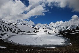
The most scenic approach to Rakaposhi BC is from Minapin to Tagafari and Kacheli. This route goes through thick forests, pastures, and green valleys. In this expedition we will take the Jaglot Nullah route to the base camp for attempting the peak.
No Records Found
Sorry, no records were found. Please adjust your search criteria and try again.
Google Map Not Loaded
Sorry, unable to load Google Maps API.
-
- Pakistan
Pakistan
Pakistan
Pakistan -
FeaturedRakaposhi (Urdu: راکاپوشی), is a mountain in the Karakoram mountain range in the Gilgit-Baltistan region of Pakistan It is situated in the middle of Nagar Valley Nagar District and Danyore and Bagrote valley approximately 100 km (62 mi) north of the capital city Gilgit of the semi autonomous Gilgit-Baltistan region of Pakistan. Rakaposhi means “Snow Covered” in the local language. Rakaposhi is also known as Dumani (“Mother of Mist” or “Mother of Clouds”). It is ranked 27th highest in the world. The Read more...
-
FeaturedDiran is located in the Rakaposhi-Haramosh Range in the western karkarm. Viewed from the Hunza Valley, Diran is a gentle pyramid and is considered to be the second easiest 7000m peak in the Karakoram after Spantik, although it has a reputation for avalanches. The Karakoram Highway runs up the Hunza Valley and gives easy access to the mountain. The first attempt Read more...
-
FeaturedAttabad (Urdu: عطا آباد), also spelt Atabad, is a town in the Gilgit-Baltistan region of northern Pakistan. It is located at 36°19’0N 74°48’0E with an altitude of 2559 metres (8398 feet), and is famous as home of the Attabad Lake. Read more...
-
FeaturedRush Peak (Urdu: رش چوٹی) is a mountain in the Karakoram mountain range of Central Asia. It is located in the Nagar District of Gilgit-Baltistan, Pakistan. While not a high peak by local standards, it is noteworthy as a remote trekking destination. It can be reached via Nagar Valley and Hoper Village. The peak can be accessed via Hoper Glacier (Bualtar Glacier) and Barpu Glacier. The peak is relatively easy to climb in the Read more...
-
FeaturedThe Bublimotin, Bubli Motin, Bublimating or Ladyfinger Peak (Urdu: لیڈی فنگر), is a distinctive rock spire in the Batura Muztagh, the westernmost subrange of the Karakoram range in Pakistan. It lies on the southwest ridge of the Ultar Sar massif, the most southeasterly of the major groups of the Batura Muztagh. The whole massif rises precipitously above the Hunza Valley to the southeast. Bublimotin, while having little prominence above the saddle with nearby Hunza Peak, is particularly notable Read more...
-