-
FEATUREDFeaturedAngel Sar or Angel Peak (Urdu: اینجل سر) is a mountain in Karakoram range of Gilgit–Baltistan, Pakistan, near K2, the second highest mountain on Earth. Read more...
-
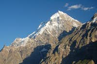
FEATUREDFeaturedPhuparash Peak is a mountain in Hispar Valley in the Gilgit District, Gilgit–Baltistan, Pakistan. It lies east of Miar Peak (6,824 m). Read more...
-
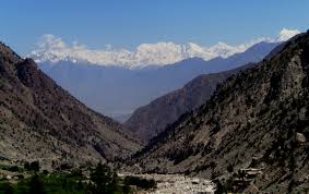
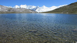
FEATUREDFeaturedHispar Pass (Urdu: درہ ہسپر, also Hispar La) (el. 5,128 m/16,824 ft) is a high-altitude, non-technical mountain pass in the Karakoram Range in Pakistan. At the pass, the Biafo Glacier (63 km long) and Hispar Glacier (4 9 km long) meet at Hispar Pass to form the world’s longest glacial traverse outside of the polar regions, 100 kilometers in length. Read more...
-
FEATUREDFeaturedYutmaru Sar is a mountain in the Hispar mountain range, a subrange of the Karakoram. At an elevation of 7,283 m (23,894 ft) it is the 88th highest mountain in the world. Yutmaru Sar is located in Gilgit-Baltistan, Pakistan. It was first climbed in 1980 Read more...
-
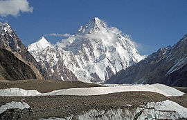
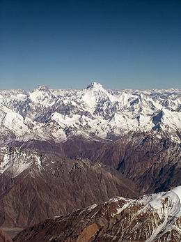
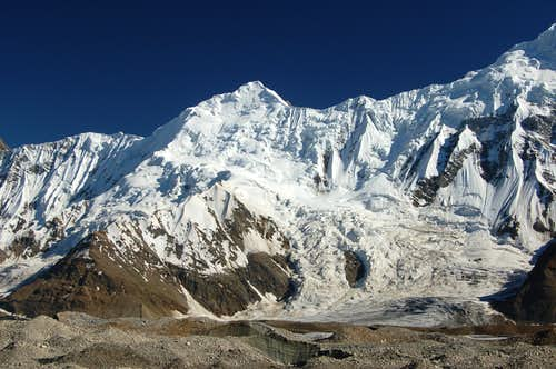
FEATUREDFeaturedKanjut Sar consists of two peaks: Kanjut Sar I at 7,760 metres (25,459 ft). Kanjut Sar II, to the south east of I, at 6,831 m (22,411 ft). Kanjut Sar I was first climbed in 1959 by Camillo Pellissier, member of an Italian expedition directed by Guido Monzino. Between 1981, August 4 and 6, 7 Japanese climbers of the same expedition climbed to the top. In 2010 Read more...
-
FEATUREDFeaturedThe Dofana ( English Dofana Peak ) is a mountain in the western Himalayas in the Pakistani Special Territory Gilgit-Baltistan . The 5940 m high Dofana is located in the northwest of the Deosai plateau , 43 km northeast of the Nanga Parbat . The summit was first climbed on June 23, 2005 by a Saxon mountaineering group (Christian Walter, Axel Grusser, Paul Sass, Martin Schörken, Jörg Schubert, Annette Longo) Read more...
-
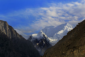
FEATUREDFeaturedThe Miar Chhish ( English Miar Peak ) is a mountain in the Western Karakorum in the Pakistani Special Territory Gilgit-Baltistan Read more...
-
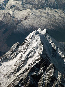
FEATUREDFeaturedRakaposhi (Urdu: راکاپوشی), is a mountain in the Karakoram mountain range in the Gilgit-Baltistan region of Pakistan It is situated in the middle of Nagar Valley Nagar District and Danyore and Bagrote valley approximately 100 km (62 mi) north of the capital city Gilgit of the semi autonomous Gilgit-Baltistan region of Pakistan. Rakaposhi means “Snow Covered” in the local language. Rakaposhi is also known as Dumani (“Mother of Mist” or “Mother of Clouds”). It is ranked 27th highest in the world. The Read more...
-
FEATUREDFeaturedThe Makrong Chhish is and Barg in that Karakorum in that Pakistani Solar Territory Gilgit-Baltistan . The Makrong Chhish is with a height of 6608 m and of the highest bars of the Spantik-Sosbun Bar . He lies up on the south side of the Hisparglets . Up the overpass Siet, 15 km north-north-east, the Kunyang Chhish boasts a height of 7852 m in Hispar Muztagh . The Makrong Chhish is flanked in the East by the West by Read more...
-
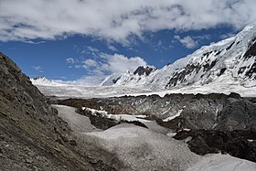
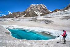
FEATUREDFeaturedHispar Glacier (Urdu: ہسپر گلیشر) is a 49 km (30 mi) long glacier in the Karakoram Mountains of Gilgit–Baltistan, Pakistan which meets the 63 km (39 mi) long Biafo Glacier at the Hispar La (Pass) at an altitude of 5,128 m (16,824 ft) to create the world’s longest glacial system outside of the polar regions. Details This 100 km (62 mi) highway of ice connects two ancient mountain kingdoms, Nagar (immediately south of Hunza) in the west with Baltistan in the east. The extreme steepness of Read more...
-
FEATUREDFeaturedPhuparash is a mountain in Hispar Valley in the Gilgit District, Gilgit–Baltistan, Pakistan. It lies east of Miar Peak (6,824 m). Read more...
-
FEATUREDFeaturedHaigutum East is a minor snow peak on the south side of the Hispar Glacier, the fifth largest glacier in Pakistan. The peak forms part of the beautiful Bal Chhish range which is a dividing marker between the counties of Nagar and Baltistan. ‘Haigutum’ refers to the grazing area further east and is the last pasture on the southern side Read more...
.